CANAL NEWS
Published by the Middlesex Canal Association
Billerica, Massachusetts
Vol. 2, No. 1 April, 1964
CANAL NEWS
Published by the Middlesex Canal Association
Billerica, Massachusetts
Vol. 2, No. 1 April, 1964
CANAL HIKE
May 2, 1964
The Spring meeting of the Association will take the form of a canal hike along a section of the Middlesex Canal in Wilmington.
We will meet in the Town of Wilmington Ball Park at 3:00pm on Saturday, May 2, 1964. The Ball Park is located on Route 38 in Wilmington, just south of the railroad overpass. It is approximately opposite the Greer Company plant and on the opposite side of the railroad from the entrance to the Avco plant.
After a short (and easy) hike along an interesting part of the Canal, we will adjourn to a convenient meeting place. We had hoped to show a color movie on the Chesapeake & Ohio Canal but regret to announce that it is unavailable at this time.
RECENT GIFTS
In the mail a few weeks ago there arrived a most generous gift for the Association Museum: four of the original certificates of stock of the Proprietors of the Middlesex Canal in mint condition.
They are a gift from Mr. J. J. OConnor of Rhode Island, having been acquired by his father who formerly resided in Quincy, Mass. Unfortunately, Mr. OConnor did not give his address and we have been unable to express our appreciation. If any reader knows Mr. OConnor, the Association would be grateful for his address.
NEWS NOTES
The Canal Museum, located in the rear of the Billerica Historical Society house at 36 Concord Road, Billerica, will reopen for the season on May 30. The House will be open to the public every Sunday during June, July and August. Interested persons may make arrangements to visit the museum at other times by telephoning the Curator, Mr. Fred Lawson at MOntrose 3-6969 or the President, A. L. Eno, Jr. at MOntrose 3-4136 . . . Contributions for publication in future issues are always welcome and should be sent to the Association, P.O. Box 593, Billerica, Mass. . . . Through the courtesy of Roland E. Shaine, Esquire, we have available several copies suitable for framing, of a reprint of an interesting contemporary account of the Middlesex Canal in the Lowell Journal of August 10, 1855. To aid the real estate fund of the Association we are offering copies for sale at 25¢ each. They will be available at the next meeting and can be ordered by mail for an additional 15¢ to cover the cost of postage and mailing. Send orders to P.O. Box 593, Billerica, Mass.
IN THIS ISSUE
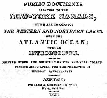
Those who were in attendance at the winter meeting will recall the splendid paper delivered by Mr. Shaine about the Erie Canal, in which he mentioned the report of the New York Canal Commissioners on the Middlesex Canal. Through Mr. Shaines courtesy, we are pleased to publish in full this report, which was published in the early 1800s.
Miscellaneous particulars of information, respecting the Middlesex Canal,
near Boston, in the state of Massachusetts.
The following information, respecting the Middlesex canal, was obtained in May last, by two of the Commissioners, who visited and carefully examined that canal, throughout its whole extent, and committed to writing, on the spot, the results of their own observations, as well as the answers to all their inquiries, which were obligingly given, by the very intelligent agent (Mr. Sullivan) of the canal company.
The canal is 27 miles long, and connects the tidewater, in Boston harbour at Charlestown, with the Merrimack river. The water in the canal is 30 feet wide at its surface, 20 feet at its bottom, and 3 feet deep. The Concord or Sudbury river crosses the line of the canal on the summit-level, 22 miles from Charlestown, and 5 miles from the junction of the canal with the Merrimack, and wholly supplies it with water for locking, down each way from the summit-level. From tide-water to the summit-level is an ascent of 104 feet, and from thence to the Merrimack a descent of 32 feet. There are, in all, 20 locks of different lifts, of which the highest is 12 feet. These locks are 75 feet long in the clear, 10 feet wide at the bottom, and 11 feet at the top.
Boats for the transportation of merchandise and produce carry 14 tons, and are drawn by one horse 3 miles an hour. Packet-boats pass the whole length in 5 hours coming down, and 7 hours going up. To each boat there are three men; two, however, are sufficient to manage the boat on the canal, the other being wanted only on the Merrimack river. From the summit-level, down the canal, there is, a current which exceeds in no place half a mile per hour there being a fall or descent in the canal of one inch per mile. The expense of transporting a ton the whole length of the canal is $3 50, of which sum $1 70 is toll, and $1 80 is freight.
Across the canal, there are 50 bridges, made by the canal company; they consist of 2 stone abutments (one on each side of the canal) 20 feet apart: from one of these abutments to the other, are laid sills or stringpieces, of wood, covered with plank, and of sufficient height for the towing horses to pass under. The towing-path under the bridges occupies 6 or 7 feet.
Two miles from the lower end of the canal, Mystick river, a turnpike road, and the canal run a little distance parallel with each other, the road being between the canal and river. Here is afforded a good opportunity of comparing the relative advantages of these three modes of conveyance.
Heavier boats than those above-mentioned, are used on the canal for transporting fire-wood, lumber, &c.; they are shaped like a scow, are 75 feet long, 9½ feet wide, and carry 25 tons of wood.
The towing-path is generally 8 feet wide, so that horses and oxen may easily pass each other. On the opposite side of the canal, where a towing-path is not wanted, the upper surface of the bank or embankment is five feet wide, and this is found to be sufficient. A branch-canal, or side-cut is made to connect the main canal with Mystick river, near Medford; this is owned by a separate company, and is principally used for transporting timber to Medford for ship-building.
The canal company was incorporated in 1789, and the next year commenced the work of making the canal. When the canal was begun, the price of labour by the month was $8. The canal was opened for use, in 1804, though not completed in 1808, when Mr. Sullivan took charge of it. Some repairs and new constructions have been made every year since. In assesments upon the proprietors, there has been laid out on the canal $528,000, and about $50,000 more, derived from tolls, has been expended in buildings, wharves, &c. At Medford is a swivel bridge, which is found to be very inconvenient. The principal articles transported on the canal are wood, timber, lumber of all kinds, pot and pearl ashes, rye, oats, provisions, and building stone from the Merrimack to Boston. Last year 12,000 cords of wood were transported down the canal, and there are more tons of timber in rafts, brought down, than of wood.
More than one half of the whole length of the canal is more or less embanked or raised above the natural surface of the ground. Above Medford is an aqueduct across the Mystick river, of which the abutments are 100 feet apart, and between them are three stone piers, each 8 feet thick, for supporting the aqueduct. The tide flows up the Mystick river above this place. The surface of the water in the aqueduct, is 10 feet above the surface of the water in the river below, at high water. This aqueduct consists of a kind of trough made of timber and plank, which has stood 16 years, but is beginning to decay. The timber is framed together in the usual way of carpenters work, by tenants and mortises, and strengthened by braces. As tenants soon rot, and give way, it might have been made on a better and more durable construction, with knees and bolts, in the manner of ship-building. At the upper end of the aqueduct, is a lock of 12 feet lift.
Mr. Weston, an English engineer, took the levels of the whole length of the line of this canal, part of the way on two routes. He estimated the expense of making it at 100,000l. sterling. The company went on to make the canal, without any further aid from any European engineer, and found Mr. Westons levels to be correct.
Over Syms river is an aqueduct, of which the abutments are 120 feet apart, with three intervening piers. The water in the aqueduct is 30 feet higher than the water in the stream below. These aqueducts all afford convenient waste-weirs. When the water is not drawn off from the canal at the commencement of winter, the expansion of its freezing, spreads and injures the timbers of the aqueducts; wherefore, it is the practice, just before the winter sets in, to draw off about one third of the water.
Half a mile above the last mentioned aqueduct, is deep cutting, 40 rods in length, through loose sand and gravel. In the deepest part of the excavation, is 20 feet below the natural surface of the earth; and the part excavated, is here, from 90 to 100 feet in width at the top. The earth was chiefly carried away in wheelbarrows, some in carts, to an embankment just above, on the right side. Half a mile higher up, the earth is very porous, and on the right side, the water leaks out through or under an embankment: this might have been prevented, by putting 2 or 3 feet of water-tight stuff in the bottom of the canal.
Near this place are two water-gates, by which the water of the canal is drawn off in the spring for the purpose of clearing out the earth, stones, &c. which fall into it, and injure the navigation. The expense of this, is perhaps $500 a year.
Mr. Sullivan states, that he has had a steam-boat on the Merrimack river for the purpose of towing boats; he found, that a man by a rope could easily hold a boat in tow, immediately astern of the steam-boat, which it would require a horse, on the bank of the river, to tow with the same velocity: such, in his opinion, is the great diminution of the resistance of the water, to the head of a boat, which is drawn in the wake of another boat.
For some weeks in the spring, the canal leaks much more than it does the remainder of the season; this is because the banks had been recently swelled and loosened by the action of the frost. Three men with a horse and boat, are, in the summer, constantly employed, to keep the banks, and particularly the towing-path in order.
The lands within six miles of the canal on each side, have increased one-third in price; while land in the country, generally retains its former value. In the state of New-Hampshire, through which the Merrimack flows, timber is now worth from 1 to 3 dollars per ton standing; before the canal was made, it was worth nothing; so that in the article of timber alone, that state is supposed to have been benefited to the amount of at least 5,000,000 of dollars. The wood-land there, has risen in price, since the opening of the canal, from $2 per acre, to $6, 8, and $10 per acre.
In Woburn, a pretty high embankment, which was made in the winter, across a marsh, sunk down in the spring, at the breaking up of the frost, so that its top was just level with the natural earth: another embankment was then raised upon it. Near this place, the canal, by a deep cutting of 25 feet, passes through a hill. An embankment at Maple meadow, in the town of Wilmington, is near 80 rods long, and 25 feet high, to the top of the towing-path. At a place called the sinking meadow, in the above-named town, an embankment is made across a marsh of about 30 rods in extent. When this embankment was commenced, it was found that the dirt and stuff carried on, to form the embankment, kept gradually sinking into the marsh; when measures were taken to ascertain how much it would sink: the labourers continued to carry on stuff which gradually went down, until the whole embankment sunk to the depth of 60 feet!
The great expense of making this embankment across the marsh, might have been foreseen, and prevented. The depth and softness of the marsh, might have been ascertained by sounding it with an iron rod, and by conducting the canal circuitously around its margin, a solid foundation might have been secured.
By the act of incorporation, the Legislature authorized the company to occupy, 5 rods of land in width on one side of the centre of the canal, and 3 rods on the other. If the owners of the land did not apply for pay within a year, it was deemed a donation. In the statement of monies expended, before made, are included, the costs of several law-suits, the building of boats, of offices, the purchase of 70 acres of land, and the erection of mills at Billerica. The land and mills cost $10,000. There is no income derived from hiring out water privileges, for hydraulic operations. The cannal receives its whole supply of water, from the Concord river; and if any were let out for hydraulic purposes, a current would be created, the inconveniencies of which, would probably more than counterbalance all the advantages of income.
Either through design or accident, logs, stumps and sticks were in some places left in the banks, when the canal was made; and these, having now become rotten, leave unsound places, through which the water escapes. A great part of the canal was made by contractors, in small parts or jobs, and where two jobs of embankment met each other, the workmen did not, in some cases, take the precaution to prevent the stones, as they threw on the stuff, from rolling down together, from each end of the separate job, and thereby forming a loose porous and leaky place in the embankment.
The aqueduct over the Shawsheen river is, between the abutments, 140 feet. The water in it is, 35 feet higher, than the surface of the river below. This aqueduct has been made 20 years; it is, like the other aqueducts on this canal, made of wood, and is so much decayed, as to require temporary props, to support it. There are three piers between the abutments, and, between the outside pier and the abutment on each side, there is a kind of wooden pier. On the inside, or river side of both the abutments, and on both sides of the piers at suitable distances, large horizontal timbers are embedded, which serve to support the lower ends of the aqueduct braces: when these timbers become rotten, the stone work will probably fall down. From each end of this aqueduct, to the distance of 500 feet, is an embankment nearly 35 feet high.
During the war, the timber used to repair the Constitution frigate, was brought, down the canal to Boston, and that used to build the Independence, seventy-four., except the live oak, was procured through the same channel, as also were many of the masts and spars, &c. which were furnished at Boston, to our vessels of war. Without the canal, this part of the country could not have supplied these necessary articles.
In approaching the Concord river, the canal passes through half a mile of deep-cutting, 800 feet of which is excavated by blasting through a hard granite rock. In some places, this blasting was carried 7 feet into the rock, and from 14 to 20 feet wide. The deep-cutting for this half mile, is from 12 to 20 feet.
Across the Concord river, a few rods below the line of the canal, a dam of 150 feet long, and 8 feet high is made. This creates a pond, out of which, through the deep-cutting last mentioned, the water flows and supplies the canal, 22 miles to Charlestown at the tide-water. From the other side of the pond, the water flows through the canal 5 miles to the Merrimack river. The water which supplies the 22 miles of the canal, passes through a horizontal apeture of 6 feet by 1, with a head of 2 feet water, above the upper side of the apeture. The towing-path, is carried across the pond, by means of a floating bridge, a part of which is occasionally drawn up, to let the logs, timber and drift-wood, which collect above pass through. There are two waste gates in the dam, by which the height of the water in the pond can, in some measure, be regulated.
In Chelmsford, within 60 rods of the Merrimack, is an aqueduct, of which the abutments are 110 feet apart, and there are ten wooden piers to support it. The water in the aqueduct, is, 16 feet higher than the stream below. Between this aqueduct and the Merrimack, is a fall of 32 feet, and 3 locks of durable stone masonry, in tarres mortar. Where the canal joins the Merrimack, a basin is excavated, 10 or 12 feet below the natural surface of the earth, and 5 feet below the surface of the river, at low water. The extent of the basin is about 200 feet on the shore of the river, and half that distance on a line at right angles with the shore, being nearly semi-circular. There are in all 7 aqueducts on the canal, but those not mentioned above are very inconsiderable: there are also several culverts. Grass grows in the bottom of the canal, and obstructs the passage of the water in autumn to such a degree, that at the lower end of the canal, 22 miles from its source, the water is sometimes 9 inches lower than it otherwise would be. To remedy this inconvenience a man is employed who wades along the canal and mows off the grass under water with a scythe. During the winter season, while the canal was not used, the muskrats would sometimes burrow into and endanger the breaking of the banks; in consequence of which the company had offered a bounty of 50 cents for every one that should be destroyed within a certain distance of the canal. This county had caused their destruction to such an extent that very little apprehension was entertained of their doing injury.
It was the original design of the company to employ three officers on the canal, viz. a superintendent, a treasurer and clerk; but that project has been abandoned, and those three officers are now united in Mr. Sullivan. His compensation is a salary of $1,500 a year, besides 5 per cent. on all the tolls or receipts, which are warranted not to fall short of $20,000 per annum.
The receipts of the company from the canal are rapidly increasing. The income in 1808, was $7000, in 1809, $9000, in 1810, $14,000, in 1811, $17,000, last year $25,000, and this year (1816) it will, undoubtedly, exceed $30,000.
Middlesex Canal Association
P.O. Box 593
Billerica, Massachusetts