
Middlesex Canal Association P.O. Box 333 Billerica, Massachusetts 01821
Volume 35, No.2 March, 1997
MIDDLESEX CANAL ASSOCIATION
ANNUAL MEETING
Sunday, May 4, 2:30 pm
Billerica Unitarian Church
There will be a short business meeting and election of officers. We plan to recognize past presidents, and the VerPlancks. Following the business meeting, Lance Metz, Historian at the National Canal Museum in Easton, PA will talk about this Museum. At this time, we will present one of our two original Middlesex Canal shovels to him for display in the Museum.
DIRECTIONS: The First Parish Unitarian Church in Billerica is the white spired church with a pillared front on the west side of the Town Common on Boston Road (Route 3A) in Billerica. The address is 5 Concord Road. Concord Road coming from the west, and Andover Road coming from the east, end at Boston Road (Route 3A) at the Billerica Town Common.
SPRING WALK
Saturday, June 7, 2pm
Our annual Spring Walk will be somewhat delayed this year in order to have it coincide with National Trails Day on June 7, 1997. The walk will be in Wilmington.
We will meet at the Town Park on Saturday, June 7, at 2 pm. Parking will be available at the Park entrance on Rte 38, or in the parking lot of Continental Cablevision, 760 Main Street, across the highway.
National Trails Day is a widespread event, sponsored by the American Hiking Society, which is dedicated to bringing good walking trails to everyone's notice and appreciation. We hope this event will draw more publicity to our sections of the Middlesex Canal.
We will see the famous oxbow turn in the Canal and the Maple Meadow Brook Aqueduct, actually walk along the towpath or in the basin of the dry bed along a wooded serene section, and end our walk at Patch's Pond, where canal boats spent the night or turned around before heading in the opposite direction.
The walk will be led by Roger Hagopian (617) 861-7868, and Betty Bigwood (508) 657-7870. Either will be glad to provide more information if needed.
PRESIDENT'S MESSAGE
The fall Bicentennial Decade Colloquium was a great success. Board member Dave Dettinger told about James Sullivan, first board chairman of the Middlesex Canal Company. Tom Smith of Woburn presented the story of the chief engineer, Loammi Baldwin.
The Middlesex Canal Commission is making steady progress in their work. The Commission recently held their first annual meeting. The Billerica section had a "charrette" planning meeting to develop ideas for canal preservation and recognition in their town.
That part of the canal route from Kilby Street in Woburn to the Merrimack River is included in the National Registry of Historic Places at this time. Our Secretary, Bruce McHenry, has been coordinating an ad hoc committee to expand the entry to include the whole route of the canal.
The National Canal Museum has been open for most of a year now. We are very fortunate to have Lance Metz tell us about it at our Annual Meeting on May 4. The Association owns two original shovels that were used in the construction of the Middlesex Canal two hundred years ago. We will be lending one of our shovels to the National Canal Museum for display. We will present that shovel to Lance at the meeting.
We have changed the date of our spring walk to coincide with a celebration of National Trails Day on June 7 in Wilmington. The walk will traverse a section of the canal in the Wilmington Town Forest and our own property.
Burt VerPlanck has written us that he does not wish to continue as a board member for health reasons. Both Fran and Burt have served as President of the Association. They have handled most of our mailings for about 20 years and our mail orders, too. They have given a great deal of their time and effort to the Association down through the years, and we should all be grateful. At the last board meeting, we voted to make them Honorary Directors.
Nolan Jones, President
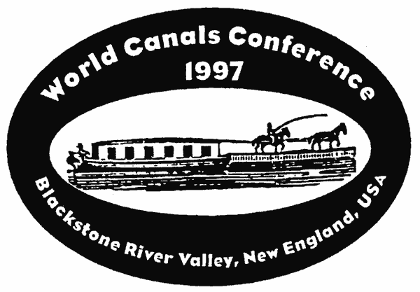
1997 WORLD CANALS CONFERENCE
Planning continues for the 1997 World Canals Conference, which is scheduled for the Blackstone Valley on October 14 to 17. Headquarters will be at the Comfort Inn in Pawtucket, RI. The Blackstone Valley Tourism Council is the lead organizing group, but the Blackstone Canal Conservancy, the Heritage Corridor, and others are also sponsors. The four days will be devoted to talks and field trips.
The conference will begin on Tuesday, October 14, with an afternoon of events in Providence followed by a tour of Blount Marine's boatyard and a dinner cruise on the bay. Wednesday will be centered around Woonsocket and the Lincoln, RI area. Thursday will begin with a train ride from Providence to Worcester, through the Blackstone Valley and along the canal, followed by talks and lunch in Worcester, a visit to Millville Lock, a longer stop at the canal at Riverbend Farm in Uxbridge, and conclude with a dinner at Pleasant Valley Country Club. Friday morning, the conference will conclude with a breakfast and tours in Lonsdale, RI and an informal meeting of the American Canal Society.
After the conference, on Friday afternoon, the American Canal Society will be conducting a four mile hike along the canal from Plummer's Landing to the Stanley Woolen Mill, followed that evening by an ACS directors' meeting.
Registration forms are available from the Blackstone Valley Tourism Council, 171 Main St., Pawtucket, RI 02860. Telephone: (401) 724-2200; Fax (401) 724-1342.
A NEW HISTORY OF THE MIDDLESEX CANAL
To mark the bicentennial of the Middlesex Canal, a new book will be published late this spring. Many of the illustrations will be in color, a first for a history of our canal. The book will contain much new information as well as illustrations.
Do you know who or what Old Hildreth is, and what his appearance or disappearance meant to canalers? Have you seen the recently discovered oil painting of the locks at Horn Pond - all in glowing color? Would you like to see what the canal looked like in 1829, when it was enjoying one of its peak years - and from the air? Could you name all the presidents of the Middlesex Canal Association?
The new book will answer these and many more questions. It is being written by Carl and Alan Seaburg, and much of the original art work comes from the talented hands of Thomas Dahill, artist extraordinaire.
The book is being sponsored by the Medford Historical Society as part of its centennial year. After expenses are paid, all profits will be divided half and half between the Medford Historical Society and the Middlesex Canal Association. This will be an excellent opportunity for us to add to our working funds.
To assist with the costs, patrons are being solicited. Their names will be printed in the book and they will receive a free copy autographed by the three authors. Anyone can become a patron and support this worthwhile project. Just send a check for $250 to the Medford Historical Society, Mr. Noah Dennen, Treasurer, 3600 Mystic Valley Parkway #705W, Medford, MA 02155. Be sure to tell us how you would like your name listed, or if you wish the listing to be in memory or in honor of someone or other.
MIDDLESEX CANAL AT THE SIA CONFERENCE
by Nolan Jones
The New England Chapters of the Society for Industrial Archaeology (SIA) held their tenth annual conference on Saturday, February 8, 1997, in the Boott Mills Museum in Lowell. I gave a short paper entitled, "Middlesex Canal, Pioneer Canal." Only 30 minutes were allowed, so it was abbreviated from my usual hour-long talks.
As a result of this presentation, I have been invited to give an expanded talk at the National Canal Museum in Easton, PA, on Thursday, November 20. Similarly, the moderator at the SIA conference suggested that the paper be converted into an article for the SIA newsletter.
THE MONMOUTHSHIRE CANAL
by Phil Hughes, Brecon & Monmouthshire Canal Trust
Our canal was in fact two canals, the Monmouthshire, which ran from Pontnewynydd above Pontypool to Newport, and the Brecon & Abergavenny, which ran from Brecon to Pontymoel just below Pontypool where it joined the Monmouthshire with a stop lock. Even though these two became one canal, they were run as separate companies until the late 1800s.
Our story begins with the industrial revolution of the middle and late 1700s. The valley of the Avon Llwyd (the Grey River) was a hive of activity with the heavy industry which had come to harness the power of the fast flowing river. (The original name, we think, for the river was Torfaen, which, when translated, means rock breaker, which would give you some indication as to the ferocity of the river when in flood.) The activity was especially noticeable when the iron foundries lit the night skies as the iron was tapped. Iron ore, limestone, and timber were in abundance in and on the hillsides around Pontypool. Coal was also discovered and this was to become a major export. Later, the Iron masters learned to coke the coal just at the right time as the timber for firewood had virtually been burned up.
The problem was, as I am sure it was in America, getting the finished product to market, i.e., to the sea at Newport in one piece and at the right price. Up to the coming of the canals in Britain in 1758, horse or mule trains and large wagons were used, but our roads then were impassable in bad weather. Thinking about it, they're not much better now.
So, in 1791, a group of businessmen in the Pontypool and Cwmbran valleys decided to build a canal from Pontnewynydd above Pontypool to Newport. They engaged Thomas Dadford Jr., who was at the time building the Glamorgan canal with his father, from Merthyr Tydfil to Cardiff. He published his proposed route in 1792, and it was put before parliament where the bill was given assent. The canal company had £108,000 subscribed before the bill was even passed in the House of Commons.
The proposed canal was to be 11 miles long on the main line from Pontnewynydd, rising 435 ft. with a total of 41 locks, with 11 in the short length from Pontypool to Pontnewynydd. The Crumlin arm would be 12 miles long, rising 358 ft. with a total of 32 locks, with 14 of them at Rogerstone above Newport. They also built and controlled the tram roads to feed the canal traffic; one went all the way from Newport to Tredegar. The canal was started on 25th of June of 1793 and officially completed by the committee meeting of April 1799, but as one section was completed, it was put into water and used.
At about the same time the Brecon & Abergavenny canal was being proposed. Originally it was not going to join the Monmouthshire canal, but was going to go down to the river Usk at Llantrisant. However, they were persuaded with an offer of £300 to join the Monmouthshire canal at Pontymoel - more about this in a later edition.
To give you some idea of the wages of the time (and you will have to do your own dollar exchange): Dadford, the Engineer, was paid for 3/4 of his time at £400 per annum; a lockkeeper, on the other hand, was paid £36/12s/6d, a mason £15/4s/4d, and a mole catcher £21/3s/0d and he could keep the skins! If you can remember back to pre 1971, there were 12 old pennies (d) to the shilling (s), and 20 shillings to the pound (£).
[ed. note: Phil has promised to send us more information about the Monmouthshire canal at a future date.]
MIDDLESEX CANAL FALL WALK - 1996
by Bill Gerber, with input from Roger Hagopian and Tom Raphael
Because heavy rains pared attendance at the Spring Walk to a very few hardy souls, who rather quickly dwindled to 4, the decision was made to schedule the Fall Walk along the same section of the Middlesex Canal, i.e. between the Concord River and Gray Street in Billerica. However, for a while, it seemed that not only did we schedule the same section, but also we might even have scheduled the same weather! But we fared somewhat better this time. Though it briefly turned windy and cold, and a heavy overcast threatened, no precipitation fell, and this walk was well attended and went as scheduled.
Surprisingly, more than 40 people turned out to do the trek. We began with an introduction to the anchor-stone and attachment structure at the west end of the towpath segment that once floated on the waters of the Concord River. This was a unique feature of the Middlesex, and is pictured on the cover of the Canal Association's handout membership brochure. (To the best of this author's knowledge, this feature was not used on any other canal.)
From Thoreau's writings we know that the floating towpath could be "breached" in some way to allow passage of boats traversing the Concord River. But it is not at all apparent just how this was accomplished. Could there have been some kind of winch assembly farther up the river that was used to open a gap at some point? It would have been essential for the gap to be clear of underwater obstructions; i.e. to allow unobstructed passage by boats. Does anyone know how this was done?
From the floating towpath we progressed to the guard lock remains, also on the west side of the Concord River, a portion of which is visible under part of the Talbot Mills parking lot. Once there was a similar lock on the east side of the river as well, though this lock has long since been "quarried" and well may be the foundation for one or more of the houses in the area. These locks would likely have been left open during periods when the water level was normal; however, except to admit and discharge boats, they would have been closed during the spring freshets and any other times that the waters rose.
From the guard lock, we proceeded by sidewalk and road around the North Billerica dam, past the site of the east side guard lock, into the region known as the "deep cut" (the "Big Dig" of 1799 or thereabouts!). In times past we have usually walked on the berm side (north side at this point) of the canal, but on a lark this time we chose to walk on the towpath side. In hindsight this was fortuitous. Not only were we reminded that this section of the towpath is still reasonably well preserved, but also we had several people along on the walk who may have found this to be an important point.
Four of our fall walk participants were from Radcliffe College, members of a landscape design seminar, who have taken on a class project to develop a proposal for a linear park along this section of the canal in Billerica. The work is being done for the Middlesex Canal Commission; it would aid in canal preservation while, at the same time, making the canal more available to the citizenry as a recreational asset (and possibly, eventually, as a component of the system of walking and biking "rail trails" that are emerging in eastern Massachusetts). In this endeavor, Billerica currently appears to be in the lead compared to any of the other communities along the canal.
Continuing east and south from the deep cut, we followed the canal until it was obscured by fill from the railroad yards in Billerica. At this point, in effect, there are now the archaeological remains of two transportation systems that have declined: the canal, of course, and the railroad that succeeded it. The railyard is no longer active; it is filled with the decaying traction engines and rolling stock of an era, now also past, when railroads were our most important arteries of commerce.
With the weather continuing to threaten, and not wishing to push our luck too far, we elected to end our Canal Walk at the east end of the Billerica Railyard. From here, we returned along the section of main line track heading toward North Billerica station. En route, we again stopped at the memorial to six of 18 Billerica victims of an 1811 smallpox epidemic, as we had done during that very soggy walk in the springtime.
This time the weather gods were with us and we finished the trip in the dry. Thankfully, the rains that became a torrential downpour by the next day, causing extensive flooding in many surrounding areas, held off for the duration of the walk and for several hours thereafter.
DESIGN CHARRETTE FOR THE
CONCORD RIVER MILLPOND PARK
February 15, 1997
by Roger Hagopian
The Billerica Section of the Middlesex Canal Commission held a day-long design charrette at the Town Hall to promote public interest, provide media publicity and come up with a variety of plans for the development of a Mill Pond Park at North
Billerica. The Commission members of the Billerica section are John Reardon, Marion Potter, Helen Knight and Carl Seaburg. A charrette is an intensive design session during which information and ideas are gathered from public officials, consultants, neighbors and ordinary citizens. Millpond Park, in the future, will be one of Billerica's finest parks for people to enjoy walking, fishing and other forms of recreation. The end product will include not only concept plans, sketches and photographs, but will establish a network of community leaders, townspeople and professional consultants, all sharing the same vision for a better town.
Marion Potter introduced the program, which began with Middlesex Canal Commission Chairman, Thomas Raphael presenting an historical chronology of the Canal, the Middlesex Canal Association, and the Middlesex Canal Commission. Margaret Ingraham, the Billerica Town Historian, presented a history of the Millpond area preceding the canal era to the present, along with personal anecdotes. Alec Ingraham showed slides and described scenes, aerial views, old photos, maps, prints, and paintings of the Millpond with the floating towpath being the focal point.
Other speakers included Charles Parrott, Architect from the Lowell National Historic Park, who lectured on the process of restoring the mills and canal walkways of Lowell, accompanied by slides showing the "before and after" conditions thereof. Jerry Van Hook of Lexington, Chairman of the Friends of the Bikeway, discussed the efforts toward connecting the various bicycle rail trails with each other and, at their intersections, with the route of the Middlesex Canal in Billerica and Lowell. Tom Horth of the Bay Circuit Alliance likewise talked about the circumventing of connected greenways around Boston and where they would cross and join the Middlesex Canal.
The final presentation was by the Radcliffe Landscape Design Course Seminars at Radcliffe College. This group proposed and presented plans, maps, drawings and photos of a linear canal park from border to border of Billerica, centering on the Millpond Park.
Much of the afternoon was spent with several teams meeting, discussing and creating ideas for the development of the Millpond area.
There are nine towns and cities through which the route of the Middlesex Canal passes. This design charrette is the pilot and model. Program organizer John Reardon says, "The end product will include not only concept plans, sketches and photographs, but will establish a network of community leaders, townspeople and professional consultants, all sharing a vision for a better town."
Roger Hagopian has produced a one-hour video summarizing the program. It will be shown by Cablevision of Lexington and be made available to cable companies in the canal communities.
THE WARWICKSHIRE RING
by David Barber
(Continued from Vol. 35, No. 1)
On Wednesday, a bus picked all of us up and dropped those of us attending the World Canal Conference at the conference center in Birmingham. The rest joined with similar groups from the Canadian and Australian Societies for a bus tour which was a dry run for the conference tour scheduled for Thursday. In the late afternoon, we all got back together for a reception and dinner held by the Mayor of Birmingham at the formal reception room in the city hall. Afterwards, we all walked to the railroad station and rode back to Hatton. On Thursday, those of us attending the conference took the train back into Birmingham while others took a train to Stratford-on-Avon and saw the town and a play. We were all back by 7pm to have a cookout with our Yacht Club hosts.
On Friday we had planned to attend various talks at the final day of the conference. However, we had been told that our planned route bypassing Birmingham on the Grand Union and Birmingham & Warwick Junction Canals was not the best and that going via the North Stratford and Worcester & Birmingham Canals was more scenic and safer. This, however, would have added many locks to an already busy Saturday, so we elected to go boating instead of conferencing on Friday.
During the conference, we had made arrangements with Tom Grasso of the Canal Society of New York State to travel with us for the day, so two of our boats waited for him to join us via the 10:30 train. On his arrival we set off for Kingswood Junction, where a short canal links the Grand Union with the Stratford. Leaving the Yacht Club with Tom aboard, it was soon apparent that something was wrong with Rainbow. Everything seemed normal, except that we could not get very much power out of the engine. Since there wasn't any good place to tie up, we motored on as best we could through Shrewley Tunnel and on to the junction. The tunnel is interesting, as there is no towpath, thereby requiring tow horses to take a path over the hill. The path descending the north side of the hill itself passes through a separate downhill tunnel. It started to rain as we left the Yacht Club and continued until we got to Lock 20.
On reaching Kingswood Junction, I tried to turn left into the connecting canal, as we wanted to shift to the North Stratford. However, without power, I cold neither force the stern around enough for the turn or stop the boat quickly. So we hit the wall firmly, flipping about ten glasses off the shelf in the galley and onto the floor in pieces. On the rebound, 1 managed to complete the turn and limp into the cross canal. Other than the glasses, no damage was done.
Here we were faced with a surprise, as the guidebooks showed the cross canal going up through Lock 20 before joining the Stratford Canal above Lock 21. However, a new link had recently been built that connects the cross canal below Lock 20 to the Stratford Canal below Lock 21, allowing boats going between the South Stratford and the Grand Union or vice versa to avoid locking up and then down. But we were going north, meaning that we had to go through Lock 20. So after waiting for a down bound boat, we entered the chamber and locked up.
On leaving the chamber, the junction was immediately ahead of us, but it was obvious that we needed help from the boat yard. Since we could tie the boat to a wall just above the lock and be out of the way of other boats, and since a British Waterways office was at the junction, we elected to stop and call for help. We then transferred Tom Grasso to Albertine, our companion boat, which locked through just after us, and we settled down for lunch.
Upon completing lunch, we decided to use the time available while waiting for the boat company. So the other five members of our crew headed off to a nearby grocery while I stayed with the boat. They were back before the boat yard person showed up, so three headed off again to a canal store located along the towpath several locks ahead. While they were gone on this trip, the boat yard repairman showed up after being delayed by traffic and an out-of-date highway map, and being confused by the fact that our boat did not have the boat yard's logo on the side.
He quickly confirmed that the problem was a loose clamping screw on the throttle cable, as we had diagnosed, and had us repaired in about 20 minutes. As the repairs were being completed, another boat came out of Lock 19 ahead, passed us, and entered Lock 20 on the side cut just behind us. Looking back, I saw two boats waiting to lock up through Lock 20. That meant that if we moved at once the next few locks would be set our way, having been left so by the down boat; but if we delayed, we would have to wait for the two other boats and all locks would be set against us.
With that situation and 18 locks ahead of us, we quickly said thanks to the repair man, cast off with only three crew members, and entered Lock 19. On leaving Lock 19, we observed our other three crew members coming down the canal from Lock 18. Quickly waving them back to open the gate on Lock 18, we rejoined and proceeded up the flight of locks. We never saw the two boats behind us after that.
Proceeding up the flight, 1 took a few minutes to visit the canal store and get a couple of souvenirs while a lock was filling. Between Locks 5 and 4, we met up with our tour leader, who had come down the towpath from the boatyard beyond the top lock after his boat had gotten there and had a sanitary pump out. At that point he had called Rose Narrowboats, who told him that we were repaired and on the way. He informed us that Tom Grasso had gotten a ride to the railroad station from the boat yard and that we needed to be at the boat yard before 6pm if we wanted to get pumped out. That left us three locks and one lift bridge to go.
With seven of us doing the work, we got there with ten minutes to spare. After being pumped out, we proceeded on through one more lift bridge to join the rest of our boats at Hockley Heath. Just after tying up, we all set off for the canal-side pub where we all had great meals and beer. Then it was back to the boat.
On Saturday, we all wanted to get an early start, as we had many locks to do that afternoon. However, we did elect to eat breakfast first, which put us fifth in the parade, although early in the morning. About a mile up the canal, we came upon Prestige, who reported that they had had an engine fire, or at least a lot of smoke. This later turned out to be from a slipping fan belt. Since they were in a remote area, we towed them for a while until we got to a boat yard. It was then about 7:30am, and the boat yard didn't open until 9:30am, but with access to services and phones, there was nothing else we could contribute.
We continued on with Serenade behind. Soon we encountered a key operated lift bridge at Shirley which we had some struggle to open, but eventually succeeded in doing correctly. After this we passed through Brandwood Tunnel, the longest of our trip. Here we encountered an oncoming boat which entered the tunnel at the far end just after we entered. Seeing it coming, I put the boat against the starboard wall and passed without problem. It was spooky passing as all I could see of the boat in the darkness was its headlight.
Farther north we passed through the infamous Lifford Lane Bridge, which was locked open. This bridge is now a swing bridge, but was formerly a lift bridge. During World War II, it became inoperable and the canal company fixed it down, blocking the canal. But at that time, a right of navigation existed on the canals and the company said that they wouldn't repair the bridge, but would open it on demand as required by law. After the Inland Waterways Association was formed in 1946, they set out to prevent further closing of canals. One of the IWA people informed the canal company that he planned to use the canal and would they please raise the bridge. This they proceeded to do temporarily with lots of workmen and cribbing, and then set it back. Soon thereafter, another member requested the bridge be raised so he could use the canal on a certain day. At that point, the company realized that this would go on forever and repaired the bridge, thereby saving the canal.
At Kings Norton Junction, we reached the north end of the Stratford Canal and joined the Worcester & Birmingham Canal. To the left, the canal descended through several tunnels and many locks to Worcester on the River Severn. We turned very sharp right and proceeded along level canal towards Birmingham. On reaching the junction, I saw several great views, but my camera needed to be reloaded and I had the tiller. So I made the turn, went through the towpath bridge and then tied up to change film and run back for the photos.
Leaving Kings Norton, we passed along improved canal with a nice towpath passing the Cadbury chocolate factory and through the grounds of the University of Birmingham. Son the canal was paralleled on the left by one of the main rail lines into Birmingham. In this section we also passed through Edgbaston Tunnel.
Just before lunch, we reached center Birmingham and took a right angle left turn before electing to tie up for lunch just before the famous Gas Street Basin. Here Serenade passed us, as they were planning to pick up Bill Trout, the American Canal Society president, in front of the convention center. After being fortified with lunch, we were ready for our busy afternoon.
Proceeding forward, we entered Gas Street Basin. Here the triangular shaped basin is split from the vertex to the base by the Worcester Bar. This is the division between the Worcester and Birmingham Canal and the Birmingham Canal Navigations. Originally, there was no water junction here and cargoes were transshipped across the bar. Later a stop lock to control water was built across the bar at the base of the triangle. Today, there are no gates on the stop lock, but its narrow width must still be passed.
On entering the basin, I was well lined up for the stop lock. But when I came out of the lee of the buildings the strong wind blew the boat sideways against a boat moored on the wall just before the lock. So I backed up into the lee of the buildings, waited for an oncoming boat, and then tried a second, successful time with more angle on the boat. We then motored under the narrow Broad Street Bridge and past the convention center where the WCC was held. Turning right at Farmer's Bridge Junction, we dodged an oncoming boat, got blown around, passed under a couple of bridges, and reached the top of the 13 Farmer's Bridge Locks.
After stopping to check out the situation, we started down with several spectators accompanying us and sometimes helping. Here the wind was a real problem as tall buildings are along the locks, and even over them and the ponds between. As a result, the wind bounces off them and blows the boat left at one lock and right at the next. This, combined with meeting other boats and lots of locks, makes for an interesting trip. But eventually we emerged from the bottom lock into a longer level.
Just before reaching Aston Junction and a left turn onto the Aston Canal, we picked up our tour leader, who had talked to the Serenade crew and wondered about Prestige. As we didn't think that Prestige would be along anytime soon, he joined us and we turned left into the Aston Canal and its 11 locks. The first lock had one upper paddle out of service and the other was difficult, but after that everything went smoothly as we descended the locks. The first locks were closely spaced, but then the distances lengthened. The landscape down this canal was very industrial and helped us appreciate the other canals we traveled.
At the lower end of this canal, we reached Salford Junction, which is built under a motorway interchange known as spaghetti junction. Here the Aston Canal, the Birmingham & Warwick Junction Canal, and the Tame Valley Canal end, as we made a difficult right turn onto the Birmingham & Fazeley Canal. At first, along this canal, we passed through more industrial landscape before emerging into the country. At the approximate dividing line, we stopped once to clear our propeller before passing through the two Minworth Locks and reaching Curdsworth, where our other four boats were already tied up for the night. We later found out that Prestige got repaired, but with the long delay, elected to spend the night in the secure moorings at Gas Street Basin. After nesting up the boats in pairs, most of the crews elected to have supper at a nearby pub. We then determined that the local grocery opened at 8:30am, and returned to the boats.
At 8:30am, our crew was first in line at the grocery, getting first pick of the limited selection, and was first back to the boat, giving us the first start of the day. We then cruised on through Curdsworth Tunnel and the ten Curdsworth Locks, reaching Fazeley Junction just after lunch. We then turned right onto the Coventry
Canal. Here we continued on for some miles more, climbing the two Glascote Locks, until we reached The Gate, the last pub before the vaguely listed planned stopping place. Since we were in the lead, we elected to stop and wait to confer with another boat. This turned out to be Albertine, but they didn't stop and we didn't get any clear answers. So we decided to go on to Polesworth, where there was a pub and other services. Eventually everyone came to the same conclusion and all boats spent the night there, including Prestige, which caught up to us late. Here, we had to wait for the pub to open at 7pm, as it was Sunday, but the wait was worth it.
As we had stopped at a variety of moorings in Polesworth, the next morning's departure was somewhat haphazard. The day began with a long level section to the base of the 11 Atherstone Locks. On reaching these, we had to wait for boats ahead, some our group and some others, and boats descending. Even helping each other, the whole flight was ragged and sloppy. On two lockages of various boats, we didn't get paddles all the way down, delaying filling or emptying until noticed. Serenade got a fisherman's keep net wrapped around the propeller, jamming its gearbox. Prestige had more problems. It also rained while we were working locks. However, by lunch time, Rainbow was above the locks and at the moorings of the village itself. So we went into the village to shop and have lunch at a tea and coffee house.
After lunch, we learned that Serenade had been repaired, Prestige was being worked on at the local boat yard, and all except Prestige and us had left town. So we proceeded off towards Marston Junction, knowing we had no more locks ahead for several days. At that point, the skies got dark and rain began in earnest, but rain suits kept us dry and moving.
In late afternoon we reached Marston Junction and turned left through the open stop lock into the Ashby Canal. By now the rain had moderated somewhat, but our crew was in revolt about going all the way to the planned stop at Stoke Golding. So, on reaching the five mile point near Bridge 15 with the Lime Kiln Pub next to the canal and with good moorings and a water point at hand, we tied up for the night. As we were returning from the pub, Prestige came along and tied up, glad to be back with some of the group. We all agreed to a 7am departure.
On Tuesday, we took on water and then left as agreed with Prestige. At Stoke Golding, the last of the other four boats was just about to leave, so we were back with the group. At Bosworth Battlefield, where Henry Tudor defeated King Richard III in 1485, ending the War of the Roses, we met another couple of our boats, and toured the battlefield together. We then continued to Shackerstone, arriving at 2pm versus the 3pm target, to visit the Battlefield Railroad and ride a train.
We then continued onto and through Snarestone Tunnel and the current end of the canal just beyond. We were supposed to stay at the terminal basin, but there wasn't enough space. So, in the small space available, we turned six boats, one after the other, and proceeded back through the tunnel to the public moorings. At the terminal basin, a couple of boats were already tied up. They elected to stay and amuse themselves watching us turn and grading the effort. One boat got a 6.5, another a 7.0. We didn't use any poles or ropes or touch anything and got an 8.0, the highest.
We then went back through the tunnel and tied up. Because of shallow banks stopping the boats away from the canal edge, one of the crew on Rambler lost his balance and fell into the canal, the only such casualty on the trip. He was uninjured and soon got cleaned up in the shower. The rest of us climbed the hill to the pub, where supper was good but a little confused. Some of the group went on a tour of the unrestored remainder of the canal with the local society, but supper confused the situation for many of us.
Wednesday, the plan was to return the length of the Ashby Canal and then proceed farther along the Coventry Canal to Hawkesbury Junction. This we did, but we woke up to wind and rain. So after breakfast we set out despite the weather. Driving wasn't much fun during the morning, but we traded off and the weather gradually improved. We weren't the first boat to leave the moorings, but, during the morning, others stopped for various reasons and we didn't. So by lunch we were in the lead. Reaching Marston Junction again, we eased out through the junction lock, which is blind due to a towpath bridge over it, stopped, and then carefully turned through another bridge.
Continuing on, the Coventry Canal was wide and deep, allowing for speed without leaving a wake. We soon reached Hawkesbury Junction, where we all spent the night in a line of boats along the canal just south of the junction. Here also we patronized the local store at the junction, a grocer farther away, and the junction pub. During the night, July 3rd, someone stole the American flag off the tiller, but I had a spare for the 4th.
The next morning, the plan had been to boat into Coventry Basin, see the town, and return to the junction. Three boats elected to stay at the junction and take a taxi into town, while three of us elected to boat into the basin and spend the night there, not leaving until noon he next day. So, after backing up to the water point, we proceeded south on the Coventry Canal. Here we found the water clearer than other canals, but shallow and with more floating debris. The route was all industrial with narrow bridgeholes. Along the way we noticed much work being done to improve the towpath and create a park-like atmosphere.
About halfway in, we snagged a large woven nylon tarp with the rudder, but we cleared it with the boat hook. We then had to stop and clear weed from the propeller. Before resuming our trip, we again used the boat hook to pull another tarp out of the canal. After that we had no additional problems.
At Bridge 1 the towpath ended and we entered Coventry Basin. Here the canal ended in a Y-shaped basin that has been recently restored with historic warehouses along one side and recent brick buildings on the other. At the point of the Y there was adequate space to turn around. After selecting our intended berth, we backed into the turning area and reversed direction with the help of some rope work. The problem was complicated by a stiff wind blowing into the basin from the top of the Y. Once turned around, we backed into the berth.
When Serenade entered the basin after us, we realized that we could use the wind rather than fighting it. Once we had then turned halfway, we found that all we needed to do was hold the stern with a rope and the wind would blow the bow the rest of the way around.
Once everyone was tied up, we went into the city to see the Transportation Museum, the old cathedral that was burned in a World War II bombing raid, the modern cathedral, the art museum, the medieval neighborhood, and other sites and shops. On our return, we patronized some of the basin-side shops for trinkets and ice cream. In the evening, we went out for supper, but found the first pub closed, the second too smoky, and the third didn't serve food in the evening. We finally found an American theme pub for supper.
The next morning, we again visited various museums before returning to the boats for lunch. After lunch we cast off, stopped for water just after Bridge 1, and returned up the canal to Hawkesbury Junction. Along the way some of our group from Serenade elected to walk the towpath. Upon reaching the junction, we had to make a sharp right turn under the towpath bridge, followed immediately by a sharp left to line up for the stop lock at the start of the Oxford Canal. We then had to wait for another boat to pass in the opposite direction before passing through the lock with its slight drop.
As we left the junction, it started to rain with increasing severity. This caused a little commotion, getting rain gear on, but all was routine after that. After a couple of hours more of cruising, we arrived back at Rose Narrowboats without incident. Here we planned to spend the night on the boats before turning them in the next morning. While we made this section without problem, Serenade wasn't as lucky. As they were passing through the next-to-last bridge, a boat going the other way didn't stop and hit them amidships, hard. No one was injured and the boat had no damage, but a casserole they had just cooked was knocked off the counter and smashed on the floor.
Once all boats reached the marina, the rain stopped. We then all patronized the canal store for the last minute souvenirs. This was followed by the traditional last night, use up the leftovers, potluck supper.
The following morning we vacated the boats early and proceeded off by bus to visit several tourist railroads and a trolley museum. The day ended in Ipswich.
On Sunday, we traveled to the Channel Tunnel and viewed some of the outside exhibits of the now closed visitors center, including a tunnel boring machine. After this we went to Hythe and rode end-to-end on the 15-in. gauge Romney, Hythe, and Dymchurch Railway. This line was built in 1909 and is the smallest common carrier railroad in the world. It has small sized steam and diesel locomotives that look just like full sized ones.
Following that, we went to Brighton to ride the oldest electric railway in Britain, the Volks Railway, along the beach. With that, we bussed back to Heathrow for the night and flew home the next day.
ORDER FORM
(1997 - prices and selection have since changed)
[Current Order Form]
| Name and Address: |
___________________________________________ ___________________________________________ ___________________________________________ ___________________________________________ |
I wish to order:
____ |
Middlesex Canal Guide and Maps by Burt VerPlanck (new) |
|
|
____ |
The Old Middlesex Canal by Mary Stetson Clarke |
|
|
____ |
Middlesex Canal Map and Profile by Col. Wilbar Hoxie |
|
|
____ |
Middlesex Canal Note Paper Packets |
|
| ____ No. |
Bicentennial Poster (refer to March 1993 Towpath Topics for description) @ $10.00 + $2.50 shipping = $12.50 ea. |
$______ |
|
____ |
"Journey Along the Middlesex Canal" Video by MCA members |
|
|
|
|
dated March, 1997