![]()
|
Middlesex Canal Association |
Volume 42 No. 3 |
Contents:
Spring Canal Walk
Upcoming Events
President’s Message
Docent Training Day
Spring Tea
MCA-AMC Fall 2003 Canal Walk Report - by Bill Gerber
and Roger Hagopian
Middlesex Canal Bicentennial Bash - by Shayne Reardon
The Proprietors of Locks and Canals on the Merrimack River:
What else did they do? - by Bill Gerber
Excerpts from Thoreau’s “A Week on the Concord and
Merrimack Rivers”
THE PAWTUCKET CANAL AT LOWELL - by Bill Gerber
LEARNING THE HISTORY OF THE MIDDLESEX CANAL: OUR FUTURE
MEMBERS - by Betty M. Bigwood
Marion Potter 1907 - 2004
A Brief Biography of Christopher Roberts - by Carl and
Alan Seaburg and Thomas Dahill
Spring Canal Walk
Middlesex Canal Association - Appalachian Mountain Club
Date: Saturday, May 1, 2004
Time: 1:30pm
Place: Winchester
Meet at the Sandy Beach parking lot off the Mystic Valley Parkway by the Upper Mystic Lakes in Winchester. The walk will follow the route of the Middlesex Canal through parts of Medford and Winchester. Sites along the way include the aqueduct and mooring basin, those segments of the canal bed and berm visible off the parkway, and the stone wall of the Brooks estate, in Medford. We will end this portion of our journey on Boston Avenue at the site of the Mystic River aqueduct, where a canal tavern, inn and locktender’s residence are located.
For more information please call (before 11pm) Roger Hagopian (781-861-7868) or Bill Gerber (978-251-4971).
Sunday, March 14 - Docent Training Day (Museum)
Saturday, March 20 - Spring Tea fundraiser (Museum)
Saturday, April 3 – Sunday, September 26 - Museum Open (Sat-Sun)
Sunday, April 25 - Middlesex Canal Association Annual Meeting (Museum)
Saturday, May 1 - MCA-AMC Spring Walk (Medford/Winchester)
This has been an active year. The Canal Heritage Days, sponsored jointly with the Lowell National Heritage Park, was a great success on the Columbus Day weekend. These events seem to be growing in popularity year by year. A group from the Canal Society of New Jersey will be joining us for the Canal Heritage Days this year. The Bicentennial celebration was also a great event on January 1, 2004, two hundred years after the completion of the Middlesex Canal.
We wish to thank all the people who donated to our fund raising request this year. Most of the things that we would like to do to preserve the remnants of the canal and publicize it do cost money and we seem to be short of what we would really like.
The Museum will be opening in early April and we need docents. Please volunteer a Saturday or Sunday when you can.
Bill Gerber presented a paper on the New Hampshire canals at the winter meeting of the Society for Industrial Archaeology in Lincoln, NH, recently. The son of a late member of the MCA has donated two notebooks on the canals of NH and the canals of New England to our museum. We will consider publishing them later on.
I am still on the trail of the Prescott Hall color slides offered to us by his son. The family has not located them as yet.
I have no speaking engagements scheduled right now. If you or your group would like a slide program on the Middlesex Canal, the Canal du Midi in southern France, or other canal subjects, just let me know.
The World Canals Conference will be in Ontario this year. If anyone is interested just let me know and I will give you the addresses. Joan and I will be on a canal boat on the Warwickshire Ring in England at the time.
Nolan T. Jones, President
<ntjones AT dragon DOT mv DOT com>
(603) 672-7051
Date: Sunday, March 14, 2004
Time: 2:00 - 4:00pm
Place: Middlesex Canal Museum/Visitors Center
Do you have an interest in the history of the Middlesex Canal? How would you like to help us keep the Middlesex Canal Museum open this summer? Even if you feel you know all about the canal, please come and share your knowledge and experience with other volunteers.
For the newer docents, don’t be afraid to join us. We pair an experienced volunteer with a newer person to relieve the anxiety!
Each volunteer is given a procedure and docent folder of information.
The Middlesex Canal Museum will open for the season on April 3rd and continue on each Saturday and Sunday through September 26th. The hours are noon to 4:00pm each day. Plan to arrive at the Museum by 11:30am to prepare for opening and expect about 15-20 minutes to close the facility.
The choice is yours as to how often you volunteer your time.
Come Join our Team! Special dates include RiverFest (in June), Yankee Doodle Homecoming (in September), and Canal Heritage Days (October).
Please RSVP Shayne Reardon if you will join us on Sunday, March14th.
e-mail (removed) phone: (978) 667-1787
Volunteers are also needed for a wide variety of other things. For
example:
Help to design, research and produce new exhibits; catalog our collections;
receipt donations and gifts; scan important images; develop strategies to better
display our collections; grant writing; fund raisers; and handyman helpers.
Date: Saturday, March 20, 2004
Time: 2:00 - 4:00pm
Place: Middlesex Canal Museum/Visitors Center
This Museum fundraiser features savory sandwiches, luscious desserts, games, music, prizes, and raffles. Tickets are $10 each ($8 for seniors). Call 978-670-2740 for tickets.
The Middlesex Canal Museum/Visitors Center is located at 71 Faulkner Street, Faulkner Mills, N. Billerica.
MCA-AMC Fall 2003 Canal Walk Report
by Bill Gerber and Roger Hagopian
We met in the parking area behind the cinema near the Rts. 128 and 38 intersection. The day was reasonably bright and sunny and the participants initially numbered about 30.
The walk covered sections of the canal north and south of Route 128 in Woburn. On the southward stretch, between the cinema access road and Kilby street, we were joined by a local resident who was rather upset about a Woburn official having apparently ordered the cutting away of a timber bridge across the canal not too far from where we entered the towpath. He was also concerned that the town does nothing to keep the towpath open as an amenity for people in the area, who might otherwise use it for walking and jogging and the like. He had a point, with relatively little effort the towpath could be cleared and made generally presentable (as has been done to the section north of Rt. 128, see below); all the better if the town would do this or if it could be done on a volunteer basis.
We continued our walk along the 200 year old canal towpath which later became the roadbed for the Woburn (Loop) Branch of the Boston and Maine Railroad. The track left the Boston-Lowell main line just north of Winchester to connect to Woburn Center. Woburn had been bypassed when the railroad followed a nearly parallel route to the east of the route of the canal. (The eastern route the RR followed was one of two that had been surveyed for the canal. It was subsequently rejected for economic reasons and because of community protest at the time the canal was built.) The portion of the branch running along the canal, between Woburn and North Woburn, lasted from 1885 to1961 and inadvertently helped preserve the waterway which it had replaced.
As our walkers approached Kilby St. we deviated from the lineal route of the railroad bed and followed the looping bypass where the canal had deviated to avoid the ledge in its path. This rocky obstacle was removed almost 100 years later by the sophisticated equipment used in railroad construction, but in 1793 there was a tendency to go around such impediments. At its highest point in this sweeping curve the earthen cut was 25 feet deep followed by a sharp curve. Here the canal narrowed to the point where only one boat could pass at a time. In recent years, construction of a residential cul de sac has again inadvertently enabled the canal to be clearly located and identified.
We stood on an empty lot above the partially watered canal as it bent its way back toward the railroad bed to which it would cling until it reached the town center. It was here that the owner of the property approached our group, curious to know what it was that drew the interest of a large group of people. We enlightened him as to our purpose and he seemed to take a keen interest in this. (Some of the most dedicated stewards of the Middlesex Canal are its abutters.)
At the end of this portion of the walk, near Winn St., we stood by the home of the gatekeeper who was in charge of the operation of the stop gates, basin, and the nearby sluiceway that was part of the means for controlling water flow in this section of the canal. Stop gates were placed at intervals along the canal to enable sections to be drained for maintenance, and to arrest the flow of water and enable repair in the event of a breached bank. The basin was one of three in the area serving Woburn center as goods were loaded and unloaded here.
A few people departed early and still more did so after we returned to the cinema area to drive over to the Baldwin mansion, once the home of Loammi Baldwin, chief engineer of the Middlesex Canal. In addition to the leaders, there were about eight people who lasted until the end.
North of School Street there is some kind of new town facility for seniors and for child day care. The last time we walked this section, the structures here housed a commercial enterprise. New fences have been erected around the refurbished and enlarged facility and these effectively block access to the canal beyond this point. It would be helpful if the town could be persuaded to put a gate in the fence to restore this access.
In a remarkable contrast, the stretch of towpath north of Baldwin’s has recently been cleared to make quite a wide path, apparently with the brush having been chipped and laid back on the path itself. For the most part, this makes walking this section very easy. It would be nice if whoever did this work could be persuaded to also cut the brush that hangs over the canal itself. This simple action would go a long way toward restoring this stretch to its 1976 state, where it actually looked like and was used as a canal as part of the American Bicentennial, when a replica canal boat drawn by a horse gave rides back to a simpler time.
|
|
 Nolan Jones |
Middlesex Canal Bicentennial Bash
by Shayne Reardon
Exactly 200 years after Col. Loammi Baldwin of Woburn hosted a “Grand Jubilee”, announcing the completion of the Middlesex Canal, modern day canalers similarly celebrated. The canal was officially completed at 2am on Jan. 1, 1804, Middlesex Canal Association President Nolan Jones said, channeling waters from the Concord River. It was supposed to be finished by midnight that New Year’s Eve, Jones said, but a lockgate problem had to be fixed, delaying the opening until the wee hours of the New Year.
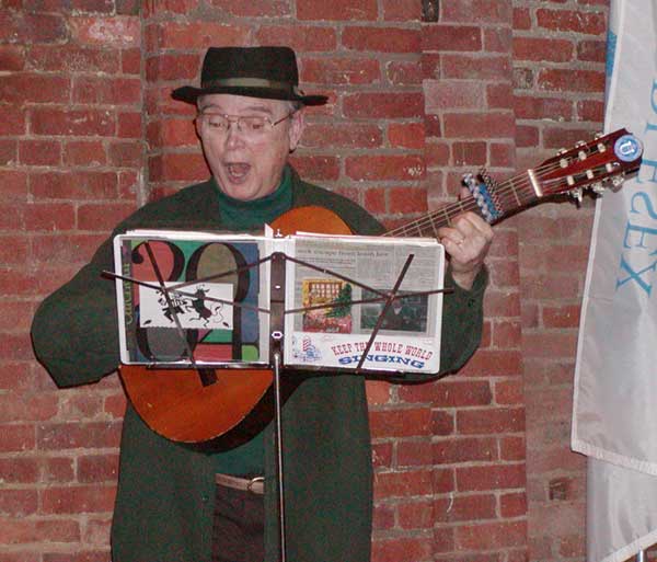
The party for the public began with a reception featuring hot mulled cider, wine and cheese, and a mixer with a “Who Am I” game to break the ice for strangers as well as those who were previously acquainted. Then sing-alongs of canal related and holiday songs, under the direction of the Middlesex Canal troubadour Paul Wiggin, took place. As if that were not enough, the guests were then feted to a late afternoon “snack” of ham biscuits, sausage rolls, homemade Baldwin apple pies, fudge, gingerbread with whipped cream, only to name a few of the goodies available.
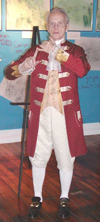
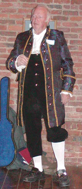
There was no charge to celebrate our 200th anniversary Bicentennial Bash and many of us arrived in period costumes - some rented and some made especially for the occasion. None of the above would have happened without the planning of Dave Dettinger. He created the concept plans as he has done for each of the Bicentennial presentations for the past 10 years. This final party, to the smallest detail, was under the direction of Dave, who looked so regal in his brocade jacket and lace jabot. With over 200 people enjoying a calmer, more gentile time, it was a credit to all the work done by our dedicated volunteers.
The Proprietors of Locks and Canals on
the Merrimack River
What else did they do?
by Bill Gerber
Toward the end of the 18th century, Merrimack Valley forests became an important source of timber and wood products. These were used for ship and home building, fuel and export, and commanded a high price in the seaport towns. But in addition to the great falls at Patucket [sic], there were other falls and rapids on the Merrimack River that presented lesser but still still significant obstacles to the transporting of these commodities to market.
In 1792, the legislature of Massachusetts incorporated Newburyport merchants and ship builders Dudley Atkins Tyng, Esq., William Coombs, Joseph Tyler, Nicholas Johnson, Joshua Carter, and others, as the Proprietors of Locks and Canals on the Merrimack River (PLC/M). The company was charged to make the river navigable by boats, rafts and masts, from the New Hampshire line to the tidal waters of the river. In the Act of Incorporation, the PLC/M were empowered to build canals and locks and perform other operations as might be necessary to remove or lessen river obstructions. Section 8 of the Act of Incorporation identified several falls and rapids requiring attention. These included: “Wickasick, Patucket, Hunt’s, Varnum’s, Parker’s, Peter’s, Bodwell’s and Mitchell’s Falls.”
During the summer of 1794, Joseph Tyler, who also supervised construction of most of the Patucket Canal, supervised “improvements” (unspecified) at Wickasick Falls (adjacent to Wicasee Island, aka Tyng’s Island, the present day site of Vesper Country Club), where the river dropped three feet in 100 rods. It seems certain that his efforts included at least the removal of stones to clear a channel through the falls. Construction of a wing-dam, blasting of ledge with gunpowder and/or other actions may also have been required to further improve passage through the channel.
(In 1812, the Middlesex Canal Company also made “improvements” at Wicasee Falls. The following year they began construction of a canal that opened in about 1816.)
In September, 1794, the PLC/M established a survey committee to determine what actions were required to render the remaining rapids navigable, “agreeably to the Act of Incorporation”, together with the probable expense to the Proprietors and the income that might be obtained if they made the investment. (The remaining rapids were all downstream of Pawtucket Falls.) The survey committee consisted of: Loammi Baldwin, Esq., Joseph Tyler, Capt. Nicholas Johnson, Capt. John O’Brien, and Parker Varnum.
Not being one of the identified Proprietors, it is interesting that Loammi Baldwin was part of the survey team; in fact, his was the first name on the list in the minutes of the meeting that authorized the team. His presence might be partially explained by the fact that he owned 13 shares of stock in the PLC/M; but there is a more likely reason.
Only a month or two earlier Baldwin had worked with William Weston, a British Canal Engineer, to survey two possible routes for the Middlesex Canal. At that time, he had an opportunity to use one of Weston’s Wye-Level instruments which provided means to make accurate elevation measurements along a survey route. (The Wye-Level was a precursor to the modern surveyor’s transit.) Baldwin borrowed one of these instruments from Weston and placed an order with a firm in London for two more, to be used by the Middlesex Canal Company. Quite likely, the Proprietors were anxious to avail themselves of the considerably improved elevation measurements made possible by this instrument, and Baldwin was the man who knew how to use it.
The conclusions of the survey committee, as reported to Proprietors in October, 1794, were that: it was not practicable to construct locks and canals by Peter’s and Mitchell’s Falls; even if it were practical, the income would fall very short of the return needed for the investment required (not less than 20,000 Pounds); but, they noted, a sum of 1,000 Pounds, prudently spent, would render all the falls navigable for boats, rafts and masts.
Since no toll could be expected, the Proprietors would not be able to recoup any investment in the lower falls. Nevertheless, they recognized that advantages would accrue to inhabitants living near the river from improvements to river navigation. Because of this, they reasoned, it should not be difficult to collect the necessary funds from contributions by local residents. With approval of the court, they opened a subscription account and proceeded to raise the money. This effort eventually raised in excess of $1400, most of which was spent on the “improvements”.
In 1795, the PLC/M appointed Col. James Varnum, Esq., of Dracut, to supervise improvements to the rapids downstream of Pawtucket Falls - to render these remaining rapids navigable, “agreeably to the Act of Incorporation” - and authorized him to expend the subscription funds to accomplish whatever actions and tasks he determined were required. The minutes of subsequent meetings of the Proprietors suggest that, because 1795 was a “wet year” and no work could be done, the work was most likely accomplished in 1796. (The improvements were probably similar to what Tyler did at Wickasick, however, no documentation has yet been found that describes the nature of either Tyler’s or Varnum’s work.)
As noted above, the PLC/M was charged to make the river navigable by boats, rafts and masts. Rafts and masts, obviously, make a one-way trip, and so the “improvements” noted above would likely have been quite adequate to facilitate their delivery. But what about boats? What provision did the company make to enable boats to return up the river? (Add this to the list of unanswered questions!)
Little evidence has yet been found of any continuing PLC/M interest in the lower falls. However, in 1818, Baldwin Family papers indicate that they did ask Benjamin and Cyrus Baldwin to survey the Merrimack again. The stated purpose of this effort was to estimate the expense of making a canal from the Head of Hunt’s Falls to the Foot of Bodwell’s Falls [in Methuen]. At least part of this work was conducted a few years later but no evidence has yet been found of any actions that resulted from this survey until construction of the Essex Dam, at Lawrence, completed in about 1848.
No evidence has been found that the PLC/M built any other canals; thus, there probably are no old transportation canals submerged behind the Essex Dam. It is likely, though, that some of the lower Merrimack’s falls were flooded out! (If anyone knows of an old map that shows the lower falls, please tell me where to find it. Current maps of the Merrimack River still show Hunt’s and Mitchell’s Falls; however, none of the other four falls are listed on any of the maps that I’ve seen. Most likely, these falls were inundated by the lake behind Essex Dam.)
Realization that the North Canal at Lawrence wasn’t constructed until 1848, just a few years before the other canals “folded”, drove research into the actions of the PLC/M. The basic questions were - what did the Proprietors do at the lesser falls and rapids, five decades earlier, to fulfill the terms of their Act of Incorporation? What, if anything, did the North Canal replace? Full answers to these questions are not yet known; and likely won’t be know unless the papers of Col. James Varnum, or the report of the PLC/M survey committee, or perhaps Loammi Baldwin’s notes from that survey can be found. In their absence, however, It might be possible to infer what was done by an archeological examination of Hunt’s and Mitchell’s Falls.
Excerpts from Thoreau’s “A Week on the Concord and Merrimack Rivers”
“Rising at an equal height with the Connecticut, the Merrimack reaches the sea by a course only half as long, and hence has no leisure to form broad and fertile meadows, like the former, but is hurried along rapids, and down numerous falls, without long delay. The banks are generally steep and high, with a narrow interval reaching back to the hills, which is only rarely or partially overflown at present, and is much valued by the farmers. Between Chelmsford and Concord, in New Hampshire, it varies from twenty to seventy-five rods in width. It is probably wider than it was formerly, in many places, owing to the trees having been cut down, and the consequent wasting away of its banks. The influence of the Pawtucket Dam is felt as far up as Cromwell’s Falls, and many think that the banks are being abraded and the river filled up again by this cause. Like all our rivers, it is liable to freshets, and the Pemigewasset has been known to rise twenty-five feet in a few hours. It is navigable for vessels of burden about twenty miles; for canal-boats, by means of locks, as far as Concord in New Hampshire, about seventy-five miles from its mouth; and for smaller boats to Plymouth, one hundred and thirteen miles. A small steamboat once plied between Lowell and Nashua, before the railroad was built, and one now runs from Newburyport to Haverhill.”
———————
“The canal-boat is of very simple construction, requiring but little ship-timber, and, as we were told, costs about two hundred dollars. They are managed by two men. In ascending the stream they use poles fourteen or fifteen feet long, pointed with iron, walking about one third the length of the boat from the forward end. Going down, they commonly keep in the middle of the stream, using an oar at each end; or if the wind is favorable they raise their broad sail, and have only to steer. They commonly carry down wood or bricks,--fifteen or sixteen cords of wood, and as many thousand bricks, at a time,--and bring back stores for the country, consuming two or three days each way between Concord and Charlestown. They sometimes pile the wood so as to leave a shelter in one part where they may retire from the rain. One can hardly imagine a more healthful employment, or one more favorable to contemplation and the observation of nature. Unlike the mariner, they have the constantly varying panorama of the shore to relieve the monotony of their labor, and it seemed to us that as they thus glided noiselessly from town to town, with all their furniture about them, for their very homestead is a movable, they could comment on the character of the inhabitants with greater advantage and security to themselves than the traveller in a coach, who would be unable to indulge in such broadsides of wit and humor in so small a vessel for fear of the recoil. They are not subject to great exposure, like the lumberers of Maine, in any weather, but inhale the healthfullest breezes, being slightly encumbered with clothing, frequently with the head and feet bare. When we met them at noon as they were leisurely descending the stream, their busy commerce did not look like toil, but rather like some ancient Oriental game still played on a large scale, as the game of chess, for instance, handed down to this generation. From morning till night, unless the wind is so fair that his single sail will suffice without other labor than steering, the boatman walks backwards and forwards on the side of his boat, now stooping with his shoulder to the pole, then drawing it back slowly to set it again, meanwhile moving steadily forward through an endless valley and an everchanging scenery, now distinguishing his course for a mile or two, and now shut in by a sudden turn of the river in a small woodland lake. All the phenomena which surround him are simple and grand, and there is something impressive, even majestic, in the very motion he causes, which will naturally be communicated to his own character, and he feels the slow, irresistible movement under him with pride, as if it were his own energy.”
———————
“Not only have some of these basins been forming for countless ages, but others exist which must have been completed in a former geological period. In deepening the Pawtucket Canal, in 1822, the workmen came to ledges with pot-holes in them, where probably was once the bed of the river, and there are some, we are told, in the town of Canaan in this State, with the stones still in them, on the height of land between the Merrimack and Connecticut, and nearly a thousand feet above these rivers, proving that the mountains and the rivers have changed places. There lie the stones which completed their revolutions perhaps before thoughts began to revolve in the brain of man. The periods of Hindoo and Chinese history, though they reach back to the time when the race of mortals is confounded with the race of gods, are as nothing compared with the periods which these stones have inscribed. That which commenced a rock when time was young, shall conclude a pebble in the unequal contest. With such expense of time and natural forces are our very paving-stones produced. They teach us lessons, these dumb workers; verily there are “sermons in stones, and books in the running streams.” In these very holes the Indians hid their provisions; but now there is no bread, but only its old neighbor stones at the bottom. Who knows how many races they have served thus? By as simple a law, some accidental by-law, perchance, our system itself was made ready for its inhabitants.”
THE PAWTUCKET CANAL AT LOWELL
by Bill Gerber
In 1980, on contract to the National Park Service, Ms. Anne Booth completed a superb compilation and interpretation of the historical documents available for the Pawtucket (aka Patucket) Canal. The following is a very short summary of the early history of the Pawtucket Canal as described in her voluminous report.
With its 30+ foot drop over a succession of rapids, Pawtucket Falls on the Merrimack was a major obstruction to the successful delivery of Merrimack Valley forest products to the seacoast. Timber had to be collected here and hauled around the falls on wagons. In 1792, the legislature of Massachusetts incorporated Newburyport merchants and ship builders Dudley Atkins Tyng, Esq., William Coombs, Joseph Tyler, Nicholas Johnson, Joshua Carter, and others, as the Proprietors of Locks and Canals on the Merrimack River (PLC/M). The company was charged to make the river navigable by boats, rafts and masts, from the New Hampshire line to the tidal waters of the river.
The PLC/M began construction of the Pawtucket Canal in 1794, generally following the course of Speen’s Brook. This effort encountered significant difficulties, such that the cost rose to double the initial estimate and the scheduled opening had to be delayed several months. The eventual opening, in October 1796, was accompanied by a nearly disastrous event; a side of the first lock (apparently at the location of the present day Swamp Locks) gave way and many of the onlookers were swept into the canal and downstream. The Directors observed: “A disagreeable incident on the day assigned for opening that canal prevented the passage for fourteen days. Due attention was immediately paid to the subject, and the lock which gave way was rebuilt in a manner which in the opinion of the Directors may quiet any apprehensions of a repetition of a like failure. The canal was thus completely ready for the passage of rafts early in November but the low water of the river prevented any custom, and the early setting in of the cold forbad us to expect the receipt of tolls until the next spring.”
Wilkes Allen, a Chelmsford historian, provided a much more colorful description of the day’s events. He writes: “The occasion had called together a great concourse from the vicinity. When a novel and very distressing spectacle was exhibited - some hundreds of men, women and children were collected, and stood around and upon the locks to witness the passing of a boat, in which were the Directors and other Gentlemen, invited by them to take a trip through the locks. Scarcely had they entered the first lock, when the sides suddenly gave way. The water, bursting upon the spectators with great violence, carried many down the stream. Infants were separated from their mothers, children from their parents, wives from their husbands, young ladies from their gallants, and men, women, timber and broken boards and planks were seen promiscuously floating in the water. Some had their clothes partially torn off, others entirely. Mothers were shrieking for their lost children, husbands swimming in search of their wives and daughters; paleness sat on the countenance and anxiety filled the hearts of those on shore, for the safety of their friends in the water. All, at length, came safely to land without any material injury. Thus ended the amusement of that memorable day.”
Between the next opening, the following year (six years earlier than the opening of the Middlesex Canal), and the summer of 1798, the banks of the canal were shored up and a guard lock was added at the current location of “Francis Gate” (though it was not known by that name until several decades later) to prevent flooding.
The canal was rebuilt and modified several times during the first two decades of its operation. In 1798, the major structures apparently consisted of a guard lock at the “Francis Gate” site, a single lift lock at Swamp Locks, and a two-lock staircase at Warren Locks (aka Lower Locks and Concord Locks). Early documents are difficult to interpret, but a second lock may have been added at the present day Swamp Locks site in about 1800. Minx Lock, a single chamber lock, was probably added in about 1801 to overcome a passage problem under low water conditions. Warren Locks were apparently rebuilt in 1802 to incorporate three lock chambers. In 1803, three (unspecified) locks were rebuilt and the need to deepen the canal was recognized. This deepening, which may have included cutting through ledge to a depth of another 18 inches, was probably completed by 1806. Documents describing any additional work are sparse but there are references to expenditures in 1816 to clear the canal, and in 1818 for the rebuilding of a lock.
A map from 1821 suggests that the canal, in that year, consisted of a single lock chamber at each of the Guard Lock, Minx Lock and Swamp Lock sites, and three lock chambers (probably a staircase) at the Warren Locks site. This was the likely configuration when, in 1821, the “Boston Associates” (William Appleton, Ebenezer Appleton, Patrick Jackson and Kirk Boott) bought controlling interest in the company - The Proprietors of Locks and Canals on the Merrimack - and by this means acquired this canal with all attendant rights and obligations.
(Claims have been made by some that the Pawtucket Canal was almost derelict and the company almost bankrupt by the time that the Boston Associates became involved. Such claims deserve further scrutiny. The minutes of the meetings of the PLC/M indicate that the company paid a dividend to the investors of $3 in 1821; $4 in 1820 and $3 in 1819. It may also have done so in prior years as well. This doesn’t sound like a company about to fail.)
The new Proprietors quickly made plans to enlarge the Pawtucket Canal to serve both water power and transportation interests. The work was performed between 1822 and 1824, during which time the canal was enlarged to 60’ width and 8’ depth above Swamp Locks; and the 30 foot drop of the Merrimack was divided into an upper level of 13’ and a lower level of 17’. To maintain these levels and the water flow needed to power the mills, dams and water control buildings were built at the Guard Lock, Swamp Locks and Warren Locks sites; and all of the locks were rebuilt in stone, each to a chamber dimension of 25’ by 110’. When completed, a single lock chamber remained at the Guard Lock, Minx Lock had been removed, a two lock staircase had been built at Swamp Locks to accommodate the 13’ change of level and another two lock staircase had been built at the Warren Locks site to accommodate the 17’ change of level. This is the configuration that remains today.
LEARNING THE HISTORY OF THE MIDDLESEX
CANAL
OUR FUTURE MEMBERS
by Betty M. Bigwood
About two years ago I received a telephone call from Dorothy Lafionatis, Wilmington Historical Commission, asking if I would help a neighbor’s child with information about the Middlesex Canal for a term paper. Of course I agreed. We spent a day together seeing the remains and my telling him the story. He got an A on the paper and then he said something, which started me thinking again: “Mrs. Bigwood, this should be taught in our schools.”
I had tried several times over the years but was told there was no money in the school budget to teach the teachers about the Canal. I have known for years that Rick Barry had taught Canal history in his class but this was only a small segment of the entire enrollment.
After initially contacting Dr. O’Donnell, I met with Dr. Lori Nielsen, Assist. Superintendent of Curriculum for the Wilmington School System. I hit paydirt! Dr. Nielsen arranged for us to meet with two Wilmington 3rd grade teachers, Traci Benvenga from the Woburn Street School and Diane Flaherty from the Shawsheen Elementary School. We then invited all the third grade teachers to the Middlesex Canal Museum in North Billerica. Sixteen! I said in amazement - yes there are sixteen third grade classes in Wilmington. The teachers spent most of a day with us as we explained as much as we could, showed slides, provided booklets with lesson plans and viewed the Museum exhibits.
In early May, I gave two consecutive slide shows to the third grade students at the Woburn Street School. This was necessary to accommodate the 100 students plus teachers at each lecture/slide show.
On May 20 through 23 all eight 3rd grade classes from the Woburn Street School visited the Museum - two classes on each of four days. Each class had about 22 students. Unfortunately the Shawsheen School did not have the resources to hire buses to take students to the Museum.
Tom Dahill, retired Emerson College Fine Arts Chairman, started the classes off by drawing for the students. We had seven docents (Shayne Reardon, Alan Seaburg, Tina Carpenito, Karen Carpentio, Debbie Fox, Carol O’Reirdon and Glenna Nickerson) at different important stations( aqueduct, lock, new exhibits) who changed groups every 10 minutes. Lunch time came quickly which was preceeded by the students drawing what they would expect to find along the canal on white paper stretched along 24 ft of two long tables. They drew well!
As the students were leaving we walked out the front door of the Museum to the Concord River falls - they were thrilled to see the water - then over to the parking lot where their bus was waiting. In the lot we drew an outline of a 70 by 9 foot boat and had the students line up at the chalk line so they could get an idea of the size of the working boats. We had a rope tied to a horse on a stick which whinnied to try and make it clear to them. They caught on quickly!
The instructors all had a good time as did the children. We were feeling quite content until someone reminded us that Billerica, this years new program, has 24 third grade classes! We have a tiger by the tail!
Marion Elma (McQuaide) Potter died Jan 2, 2004. Born in Lowell in 1907, she married Billerica native Stuart Potter in 1933 and helped run the farm that had been in the family for generations.
A traditional skating party at Potter’s was the site for the winter meeting of MCA on Sunday evening, Jan 26, 1964. Although the dream of skating on the Canal was not to be, Marion and her husband, Stuart, extended their usual hospitality for skating on “Potter’s Pond” at their home on High Street. After skating and refreshments, a panel discussion with slides of four foreign canals was held. “Members and their families and interested guests are cordially invited to combine exercise and enlightenment in what last year proved to be a most enjoyable evening.” (Canal News, Vol.1, No.2, Jan 1964)
Marion was a charter member of the Middlesex Canal Association, as well as a Member and Chairperson of the Middlesex Canal Commission, a group which encompasses a membership from all nine of the towns through which the canal passes. After her husband’s death in 1975, Potter worked to re-establish the Billerica Chapter of the Middlesex Canal Commission. Marion retired from the Commission and was feted to a tea on June 2, 2002 with more than fifty people joining in with fond tributes and good wishes. Marion always welcomed newcomers with warmth and with guidance in the workings of a Board and always helped to get things done.
Marion served as a Town Meeting representative for 44 years and as a precinct officer for 24 years. She served three terms as president of the Billerica Historical Society and is credited with preserving much of the town’s history. Her presence in the town and in our lives will be greatly missed.
A Brief Biography of Christopher Roberts
from: The Incredible Ditch by Carl and Alan Seaburg and Thomas Dahill, c1997
In 1938, the finest account of the canal appeared. This was written by Christopher Roberts. Roberts was born in Newark, New Jersey in 1897. During the First World War he served in France in the American Friends Relief Unit, and was a Captain in the American Red Cross. He did his undergraduate work at Haverford College where he got his B.S. in 1920. From Haverford, he went in 1921 to Harvard to do graduate work in economics. In 1922, he earned his M.A. and began to study for his doctorate, which he received in 1927. To support himself at Harvard he worked as a tutor and an instructor in economics.
His doctoral dissertation was about “The Middlesex Canal.” This subject had been suggested to him by Professor Edwin F. Gay and was based on the fact that the research of Walter R. Harper had uncovered the official records of the Middlesex Canal Corporation. Basing his work on this hitherto unused manuscript sources and a collection of Baldwin family manuscripts, now in Baker Library, which Roberts discovered, he put together a solid history of this initial experiment in corporate organization and of the relations of a public utility to the state and community it served.
In 1929, Roberts was appointed an assistant professor of economics at Duke University in North Carolina and taught there until 1935. During the summer of 1930, he traveled through England and France doing further canal research work. In 1936 he returned to Harvard and began working on transforming his dissertation into a book. During this time he was also a lecturer on economics at the university. The book was published in 1938 by Harvard University Press as volume 61 in its economic studies series. It sold for what looks like the relatively modest price of $3.00, but this was in the years of the Great Depression when workers lived on $10 a week and were elated to earn $15, so it was the equivalent of a $50 book today. The book is dedicated to “W.R.,” his father, Weldon Roberts.
Instead of returning to teaching, he joined his father’s firm in Newark, the Weldon Roberts Rubber Company. During the Second World War, he worked in the lend-lease division of the Department of Commerce in Washington, D.C. and in their Bureau of Statistics. In 1946-7, he was in Berlin, Germany as an economic advisor for the U. S. government. He then became a vice-president of the Weldon Roberts Company living overseas in Europe. In 1949, he died of a heart attack in Vervey, Switzerland. His only survivor was a brother, Garrett. But this 242 page volume - his only known work - remains as a monument to him, and a vital resource to students of the Middlesex Canal.
Editor's Note: Towpath Topics is the official newsletter of the Middlesex Canal Association. It has been published at least twice per year since October 1963. A project is underway to post all of these back issues on our web site (www.middlesexcanal.org) in a searchable format. An index of the contents of each issue is also under construction. – Robert Winters, Editor and Webmaster